
|
|
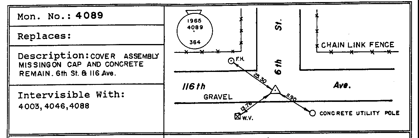
Sketch Cards or Marker Location Diagrams are now available, free of charge, for final markers via a MASCOT query. They are accessible by using the Type final link on the Selected GCM List for the specified GCM and then clicking on the Card01 link found with the marker location description as shown in the following example;
SIT. IN DAWSON CREEK, ON S. SIDE OF 116 AVE. AT
   JUNCTION WITH C/L OF 6 ST.
A.M. BARBER & D.E. WATSON CONTROL SURVEY 1967.
McElhanney (A. Petzold) control survey 1991.
MKD. BY B.B., UNDER IRON COVER.
The Card01 link can also be found at the bottom of the Geodetic Control Marker - Long Form page which is loaded after clicking on the chosen GCM# link of the Selected GCM List.
To print a sketch card, first save the image on your hard disk and then use available packages on your computer such as MS-Imaging, MS-Word or other commercially available packages as ACDsee or freeware as Lview to print them. Here is a simple explanation as how to print sketch cards using MS-Imaging and MS-Words:
MS-Imaging: for this you will need to use only MS-Internet Explorer (i.e. Netscape can not be used). Right click your mouse on the browser’s sketch image and select the option "Save Picture As…" and save the image on your hard disk as a .BMP (bit Map) then fire up Imaging and open the image and print.
MS-Word: After saving the image in its original .GIF format on your hard disk, it does not need to be in .BMP format, in MS-Word select the options Insert - Picture - From File. You can insert all the required sketchs and then print the Word document.
Return to MASCOT Home Page
For information on MASCOT in B.C., please contact: